SW 10TH STREET & I-95 PD&E STUDIES EXHIBIT ROOM
Welcome
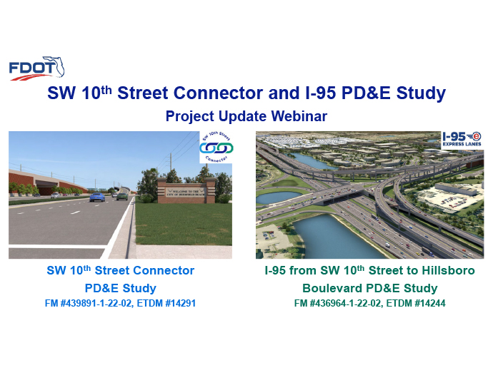
The Florida Department of Transportation (FDOT), welcomes you to the Exhibit Room for the Virtual Project Update Webinar for the SW 10th Street Connector and I-95 PD&E studies.
The Exhibit Room is intended to provide information on the history of the project alternatives as well as the most recent changes that have been developed in response to concerns voiced by the City of Deerfield Beach as well as the Broward Metropolitan Planning Organization (MPO).
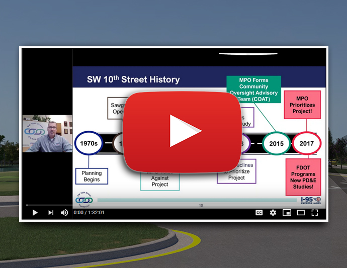
During the upcoming Project Webinars the Project Team will be summarizing and explaining much of the information you will see in this Exhibit Room.
To navigate through the Exhibit Room, click on the arrows on the right and left side of your screen or use the navigation pane on the left to jump to the sections that interest you most.
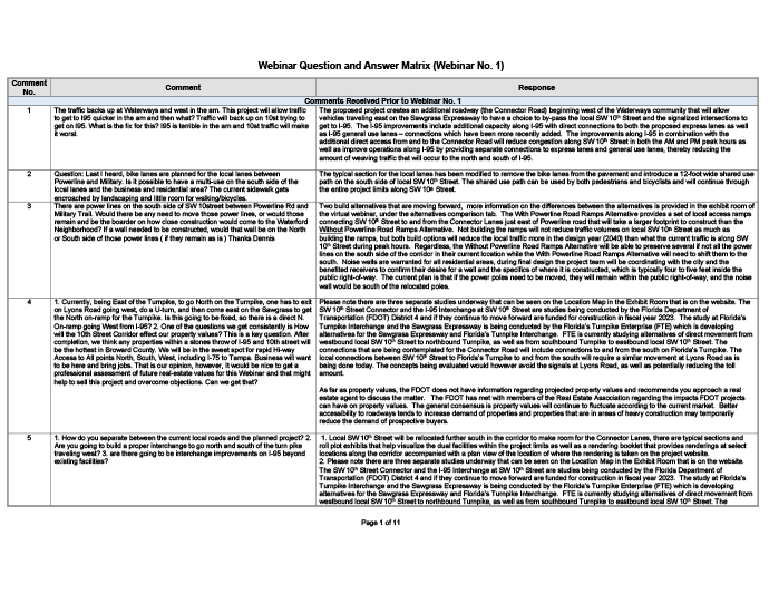
Please submit any comments or questions you may have at any point during your review of the exhibits by simply clicking on the “Comment” button at the top right of your screen. The FDOT will incorporate comments and questions into the webinar presentations as well as the question and answer period that will follow the presentation. Please note that the presentation material will be the same for each of the three proposed webinars.
Webinar Information
Thank you for viewing the exhibits in advance of the webinar. We understand that your time is valuable. Therefore, we are striving to make this experience as efficient and understandable as possible. The information on the exhibit to your left provides more details on the format and procedures for the webinar including how to submit questions in advance of the webinar.
Webinar Materials (slides/questions)
Project Location Map
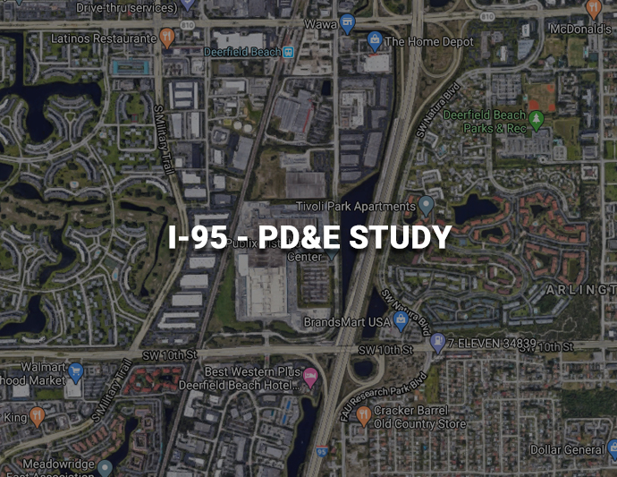
This exhibit room and webinar features two studies. The SW 10th Street PD&E Study begins near the interchange with Florida’s Turnpike and extends to just west of I-95. The I-95 PD&E Study begins just north of the Green Road/NE 48th Street overpass and extends through the interchange with Hillsboro Boulevard.
PD&E Process
A Project Development and Environment (PD&E) study is the formal process that develops and compares alternatives to determine a preferred action that meets project needs, while minimizing impacts to the social, natural, and physical environments. Engaging the public by sharing and receiving information is a key component of this process and required by the National Environmental Policy Act (NEPA).
Purpose and Need
The primary purpose of the SW 10th Street Connector project is to connect the Sawgrass Expressway with I-95, thereby improving connectivity of the entire limited access, high speed system in the area. This connection will facilitate improvements to local SW 10th Street by removing traffic and improving bicycle and pedestrian facilities.
The purpose of the proposed I-95 improvements is to address operational deficiencies and expand capacity along the interstate, including improvements at the Hillsboro Boulevard and SW 10th Street Interchanges, as well as direct connect ramps to the SW 10th Street from I-95. These improvements will provide system connectivity that is part of a larger system of planned improvements along I-95 to satisfy long-term transportation demand and facilitate hurricane evacuation.
Schedule
The FDOT is looking to receive your feedback through the webinars as well as additional stakeholder meetings/webinars throughout the summer, and at the Public Hearing planned for September of this year. After the public hearing, all comments will be considered, and the FDOT will make its final recommendation. As we approach the end of this study, your comments are particularly welcome. Final approvals of the studies are expected in June 2021 which will allow for the final design phase of the project to begin.
COAT Recommendations
Prior to the current PD&E study, the Broward Metropolitan Planning Organization (MPO) formed the Community Oversight Advisory Team (COAT) that developed several recommendations for the FDOT to consider for the study. These recommendations address multiple aspects of the project and have guided the development of the alternatives.
SW 10th Street Typical Section
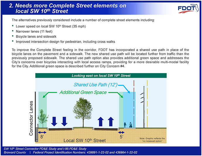
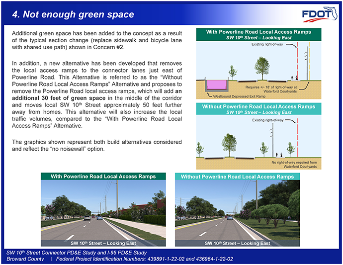
Two facilities are proposed within the SW 10th Street corridor. One will be a “connector road” facility to provide a high-speed connection between the Turnpike / Sawgrass expressway and I-95. The other facility will be a local, lower speed roadway to serve businesses and communities within the corridor. A shared use path along with substantial landscaping and aesthetic improvements will be included.
Public Engagement History
Numerous meetings with stakeholders as well as major public meetings have been held for this project. Each meeting has helped form where we are at in the project’s development.
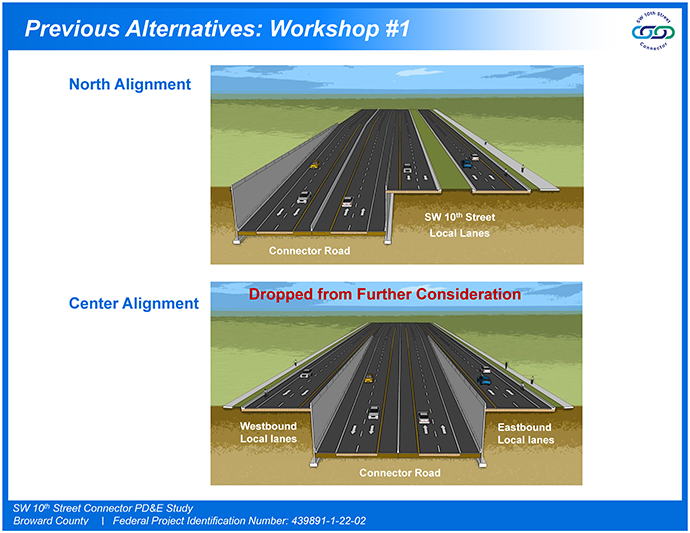
The first graphic illustrates the alternatives presented at the first Alternatives Public Workshop in April 2018, where a North Alignment and Center Alignment were presented. The North Alignment places the Connector Road on the north side of the corridor and the local lanes on the south side of the corridor. The Center alignment places the Connector Road in the center with local SW 10th Street on either side as one-way frontage roads. Based on feedback from the April 2018 Public Workshop as well as community and stakeholder meetings, the North Alignment was favored and carried forward for further study.
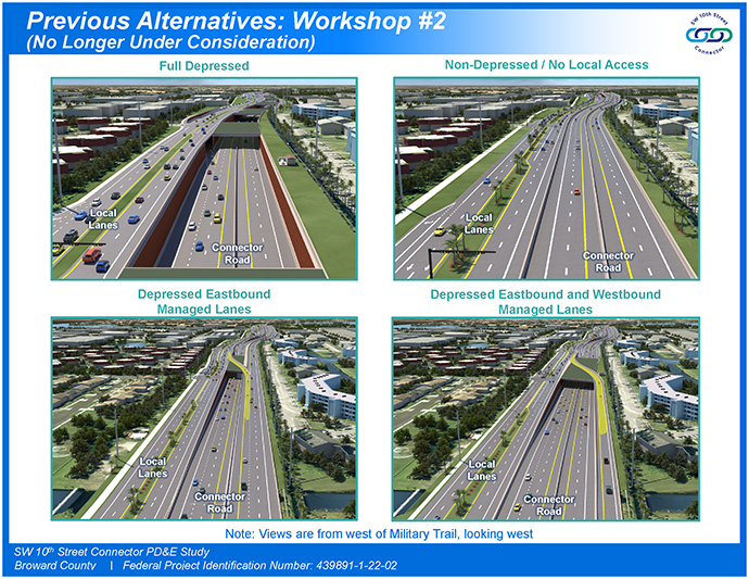
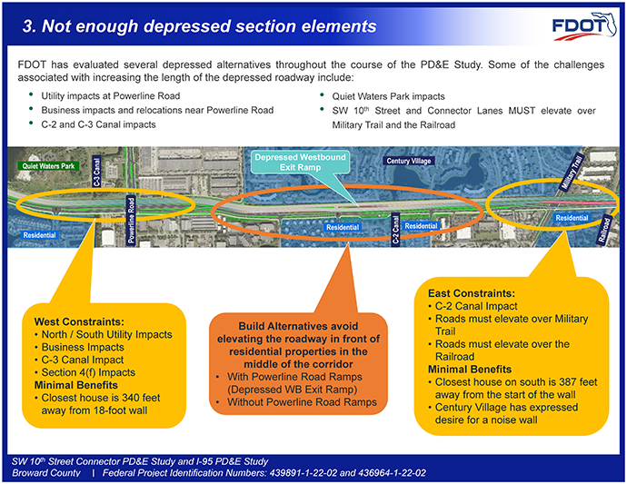
The second Alternatives Public Workshop was held in November 2018, and three primary alternatives were presented. The Full Depressed Alternative, North Alignment from the first Alternatives Public Workshop was included as well as a Partial Depressed Alternative comprised of three sub-alternatives showing different variations of the proposed westbound exit ramp. A Non-depressed, No Managed Lane Access Alternative was also shown. The second graphic illustrates the options from the second Alternatives Public Workshop that have been eliminated from further consideration.
Following Alternatives Workshop No. 2, the bridge near the Waterways entrance was moved further west, trucks were determined to be able to use the Connector Lanes, and the Connector Road will open without tolling, initially based on feedback from Workshop No. 2.
Recent Project Enhancements
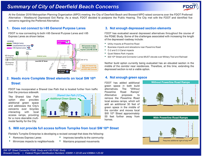
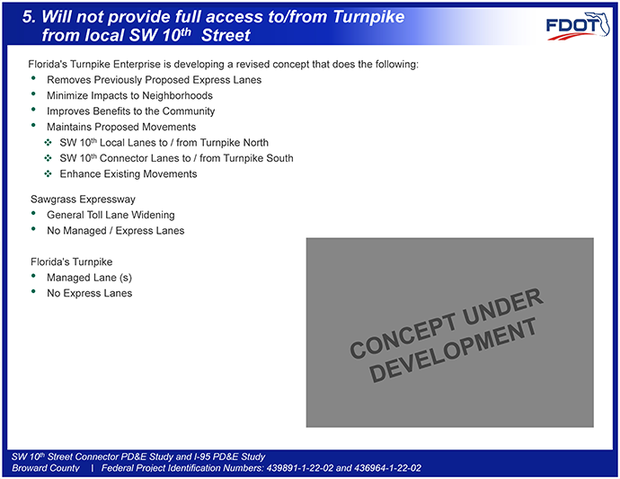
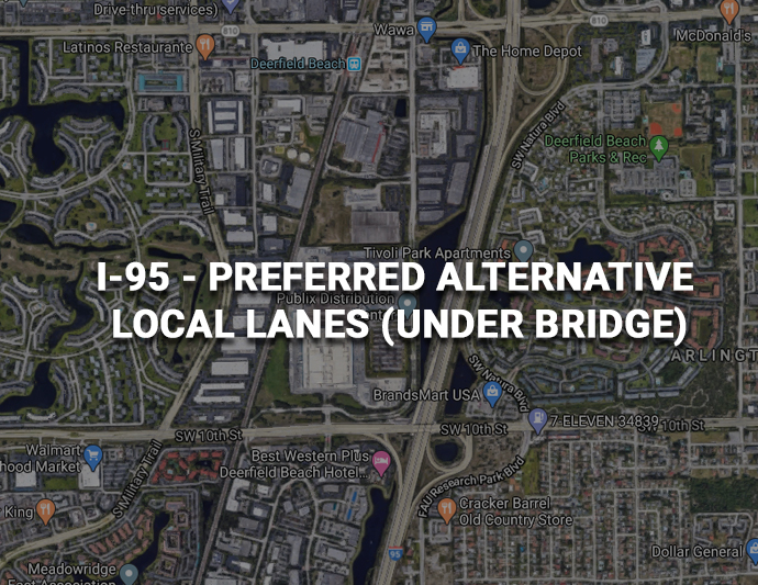
In October 2019, the City of Deerfield Beach expressed several concerns regarding the Preferred Alternative. FDOT has spent the past six months meeting with the City and working on the various issues. The exhibits below illustrate these concerns and the proposed changes to address them.
Alternatives Under Consideration
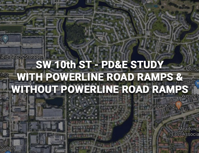
The large-scale exhibits reflect the proposed alternatives placed on top of the existing aerial photography for both the SW 10th Street and I-95 Studies. These exhibits can be zoomed in on and you can pan throughout to see any particular area that you are interested in. Please note that the PDFs may take some time to download or for the display to update due to the file size. A new alternative was developed that eliminates the local access ramps to and from the connector lanes just east of Powerline Road in the SW 10th Street file. The new alternative, Without Powerline Road Ramps is shown as an inset to the overall exhibit since this alternative only changes roadway elements between Powerline Road to West of Military Trail.
There is an exhibit for the Newport Center Intersection that does not depict the bridges in order to provide a better view of the surface streets and intersection.
Access
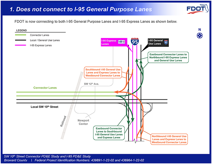
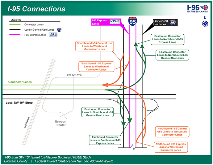
Access has been a major concern for the project: The I-95 Connections Exhibit includes recent changes that have added connections to both the I-95 Express Lanes and the I-95 general purpose lanes from and to the connector lanes. This new configuration helps reduce the local traffic volume as well as provided more options for vehicles on the connector lanes.
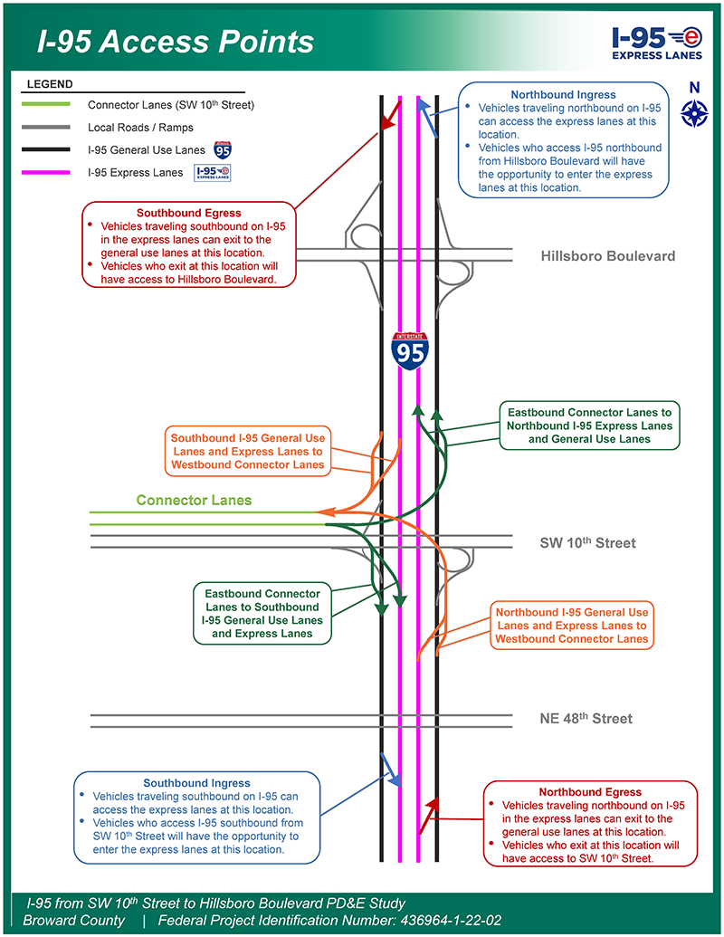
Access along I-95 is shown on the I-95 Access Points Exhibit which identifies what interchanges are accessible to and from the express lanes as well as access to the connector lanes.
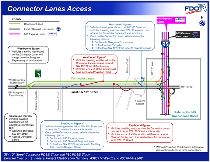
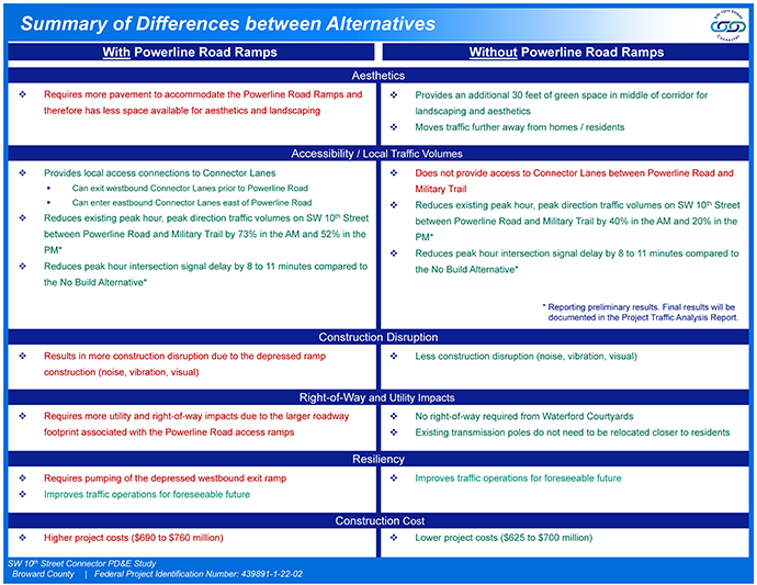
The Connector Lanes Access Exhibit reflects the different access points to and from the Sawgrass Expressway, I-95, and Local SW 10th Street with the connector lanes. Note that the ingress and egress to and from the local lanes to the connector lanes just east of Powerline Road could be eliminated with the Without Powerline Road Ramps Alternative which would result in more traffic utilizing local SW 10th Street in exchange for more green space for potential landscaping. The FDOT is looking forward to hearing your feedback on this new alternative.
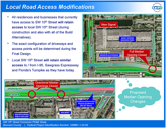
The Local Road Access Modifications Exhibit explains that all residences and businesses that currently have access to SW 10th Street will retain access to local SW 10th Street. The exhibit also shows the proposed access modifications along SW 10th Street (new signalized intersection on Powerline Road, and the proposed closure of three median openings).
Aesthetics
Noise
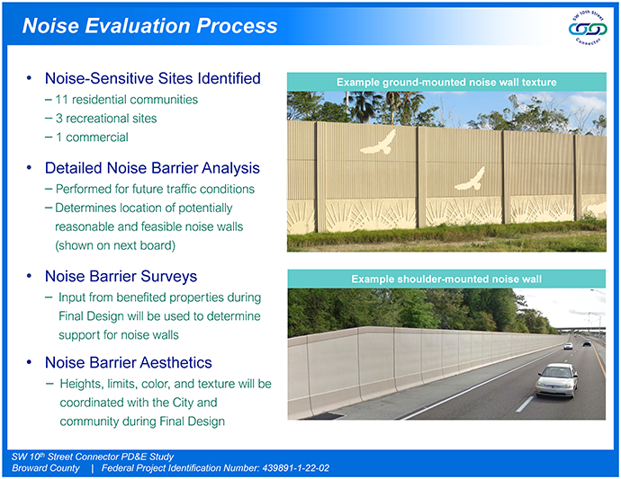
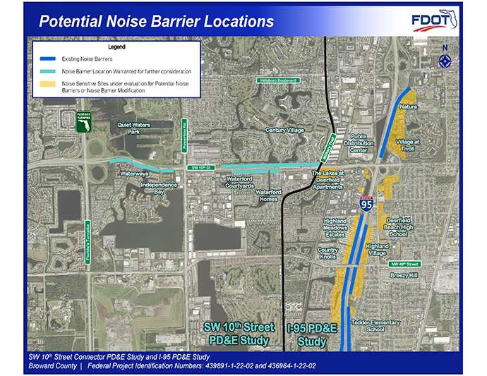
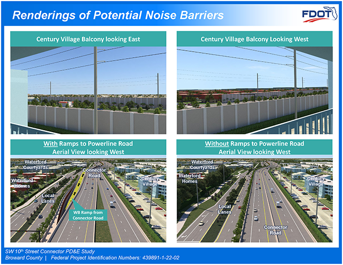
The federal process for noise wall evaluation includes acquiring existing noise levels in the field followed by a detailed modeling component. The exhibits in this section describe the evaluation process as well as a display of the Potential Noise Barrier Locations that have been warranted at all residential areas along SW 10th Street for both alternatives under consideration as well as areas that are still under analysis with the I-95 Study.
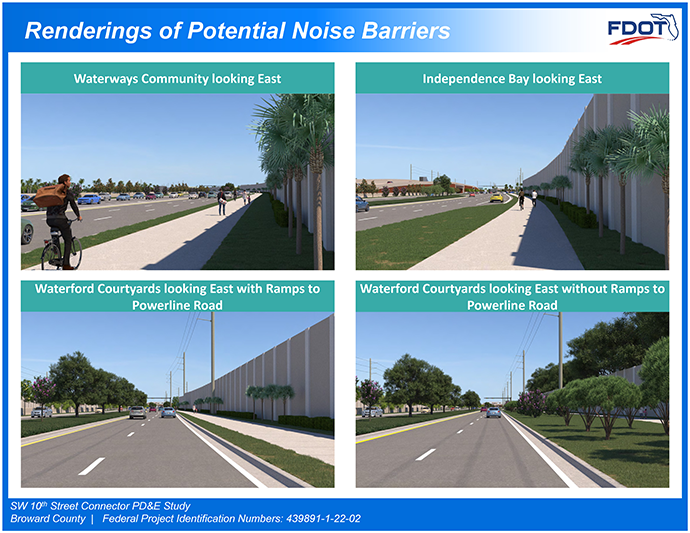
The Final display reflects a few of the renderings that include noise barriers at communities if they are constructed.
During final design, the owner of each benefited property will have the opportunity to express a preference regarding the construction of noise walls.
Renderings
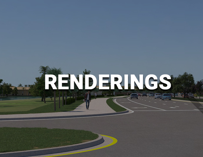
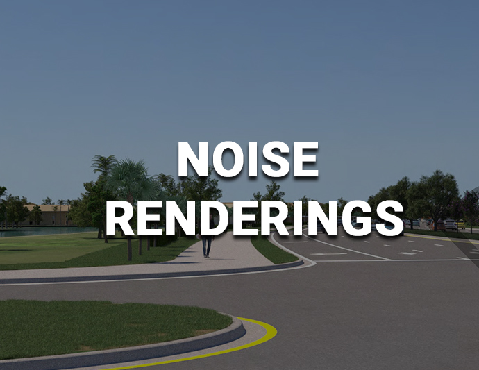
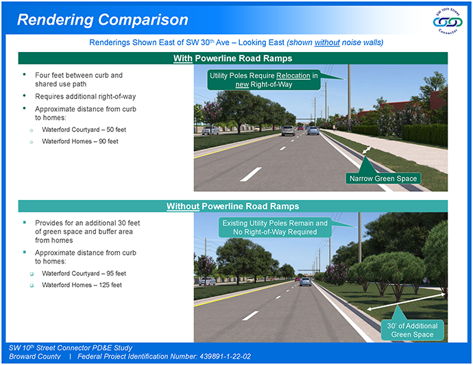
To help illustrate the alternatives under consideration, the FDOT has prepared a number of renderings at select locations throughout the projects. Two “booklets” are provided that reflect renderings for the With and Without Powerline Road Ramp Alternatives. The first rendering booklet includes renderings along SW 10th Street and I-95 for both build alternatives with no noise walls shown. The second rendering booklet shows renderings with noise walls along SW 10th Street.
Alternatives Comparison
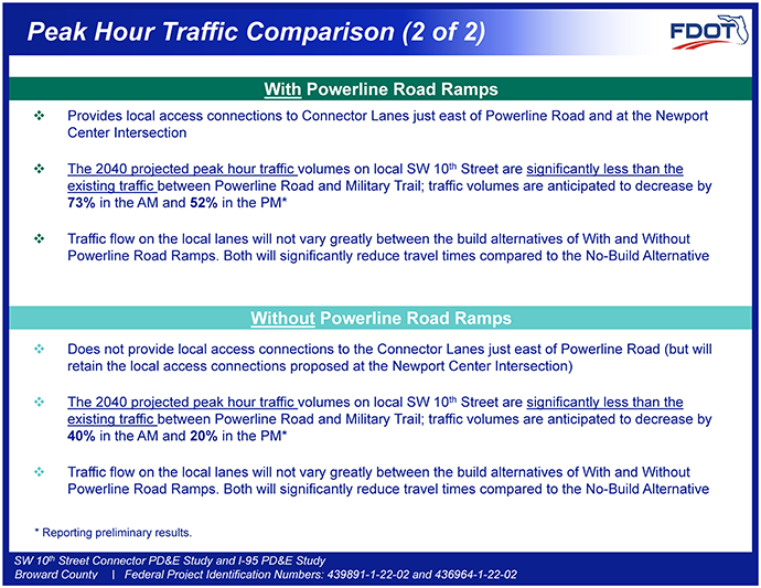
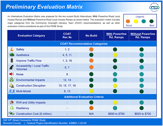
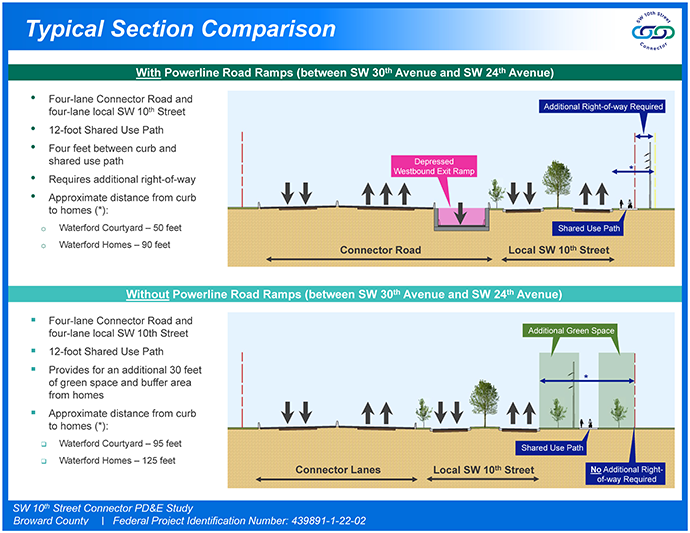
The exhibits in this section are meant to help assist in evaluating the options “With” and “Without” ramps to Powerline Road, a tabulation entitled “Preliminary Evaluation Matrix” has been prepared. This comparison provides an evaluation using a color-coded chart for each category considered. The No-Build option remains under consideration and is also included. The dark green color is the best and orange is the worst. The second exhibit shows a side-by-side comparison of the alternatives with more details of the preliminary analysis.
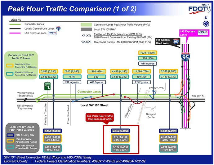
The remaining exhibits in this section provide a more detailed comparison of the renderings, typical section elements, and traffic volumes. The traffic comparison board shows that both build alternatives reduce future (2040) traffic volumes on local SW 10th Street to less than the existing (2016) traffic volumes.
Please provide your feedback on these alternatives and the information provided to help assess them.
Other Studies (Turnpike)
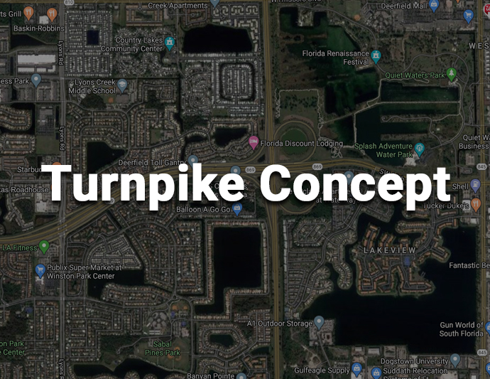
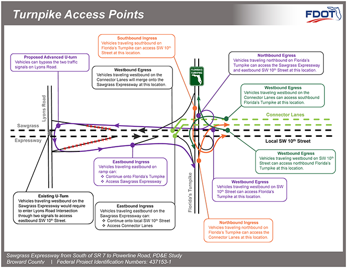
Please note that there is a separate study being conducted by Florida’s Turnpike that is on-going. Florida’s Turnpike is currently developing concepts for the Turnpike Interchange with the Sawgrass Expressway and SW 10th Street. The SW 10th Street Study and concept alternative(s) have been coordinated with the interchange project so each study’s concept can exist with or without the other. The Turnpike Concept is currently prioritizing making connections to and from the south with the connector lanes and to and from the north with the local lanes. The other movements at the interchange will be function similar to how these movements are made they do today although, the Lyons Road uturn will be modified to by-pass of the signals at Lyons Road.


